
Tayma Oasis: Water, Settlement and Archaeology
Understand Tayma oasis through water landmarks, settlement remains, environmental research and the Tayma stele, with source-linked cultural context.
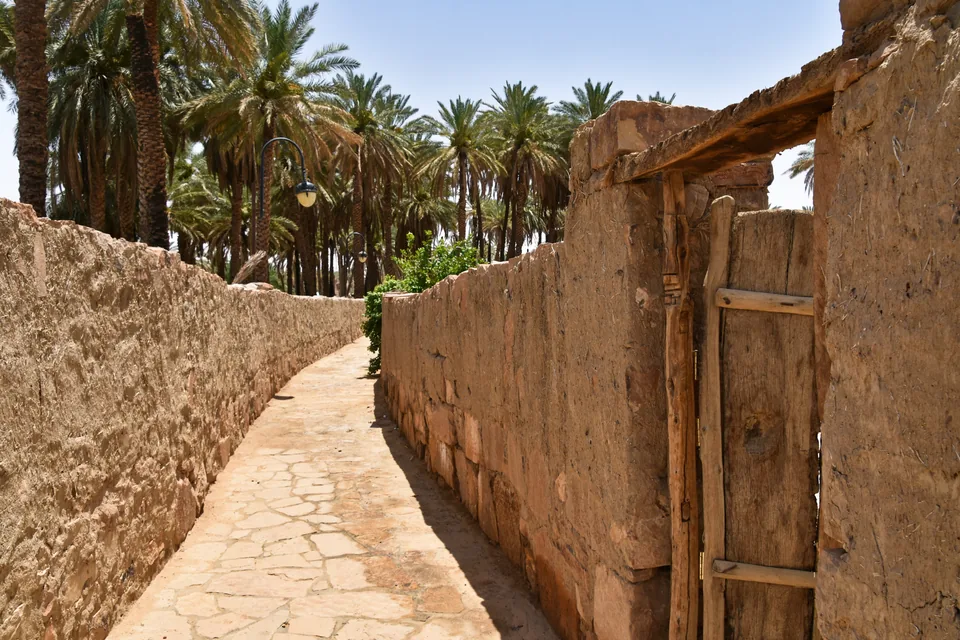

Tayma is an inland oasis in Saudi Arabia's Tabuk Province whose history becomes clearer when water, settlement and objects are studied together. A well, a ruined building and an inscribed stone answer different questions. They should not be compressed into one timeless image of a caravan town. This guide explains how those kinds of evidence connect, how to distinguish Tayma from other northwestern destinations and how to build an informed reading of the oasis before a visit or museum encounter.
The focus is cultural understanding. Historical photographs and research descriptions do not establish today's opening hours, access arrangements or water conditions. The sources below were reviewed on 4 October 2026. Where research offers an interpretation, it remains attributed; the observation exercises are original suggestions for readers rather than reports of a visit by this website.
Place Tayma within Tabuk Province
Begin with the administrative geography. Tayma belongs to Tabuk Province in northwestern Saudi Arabia; it is a separate place from Tabuk city. The Tabuk Region guide provides the wider provincial orientation. A province can contain coastal towns, inland settlements and very different heritage settings. Choosing a regional label is therefore only the beginning of understanding where a photograph or historic reference belongs.
Keep a simple place list beside your notes: province, town, named site and present object location. A reference to Tayma's old town is not interchangeable with a reference to an excavated area. Equally, an artifact originating in Tayma may be photographed in a museum abroad. Its place of discovery and place of display tell different parts of its story, and both deserve space in the caption.
Use the spelling Tayma consistently in your own notes while retaining the exact title of any catalogue record you cite. You may encounter Taymāʾ or Teima in specialist or museum references. The variation can make searches look as if they concern different places. Check the record's discovery location and inventory number before joining sources together, particularly when several inscribed stones appear in the same search results.
Understand the oasis as an organised landscape
An oasis is more than a group of palms in a desert photograph. For a historical settlement to be understood, the reading needs to include water access, cultivation, buildings and movement between them. The German Archaeological Institute's Tayma project overview describes research into environmental and settlement history and wider cultural contacts. Its listed project period is 2004–2019; that is a research timeframe, not the age of the oasis.
One useful exercise is to imagine removing the famous monument from your mental picture. What would you still need to explain? Gardens require arrangements for water and work. Settlement requires places for storage, circulation and daily activity. Connections with other regions require more than a line drawn across a map. These are questions for interpretation, not claims that every surviving feature has an identified ancient function.
The DAI overview identifies early oasis cultivation and substantial Bronze Age development. That research account places Tayma's development within a long sequence of cultivation and settlement, rather than reducing the oasis to one period. It helps shift attention toward local communities and long-term development. Archaeological dating depends on the particular evidence and interpretation; a period cannot be read directly from a palm grove or a standing wall.
Read water evidence beyond a famous well
Saudipedia's archaeological overview, dated 26 December 2022, identifies Haddaj Well in ancient Tayma and lists Qasr al-Hamra among the area's landmarks. The named well gives a reader a concrete starting point for thinking about water. It does not, by itself, explain the supply arrangements for every period or establish that a present water source is suitable for drinking.
Separate the visible structure from its historical interpretation. A photograph might show an opening, built edges or a relationship to surrounding palms. Questions about depth, discharge, construction phases and the area supplied need documented evidence. Looking carefully can generate those questions, but it cannot answer them all. Record what a responsible site explanation says, then identify which claims depend on archaeological or hydrological investigation.
Consider a hypothetical label saying that a well served a settlement. The next question is how that conclusion was reached: through channels, water-related installations, an inscription, historical writing or a combination. Each kind of evidence has a different reach. A description of one period need not describe another. This approach turns the well from a single sightseeing stop into an entry point for understanding the practical organisation of an oasis community.
Let environmental research extend the timescale
The DAI vegetation and land-use project, listed for 2011–2015, used pollen from former lake sediments alongside botanical remains such as fruits, seeds and charcoal. Its purpose was to reconstruct environmental change and land use. This is a different evidence base from a building facade or a written inscription. It investigates processes that may leave little recognisable material above ground.
The distinction matters when a modern scene seems to contradict a historical account. A present dry surface does not prove that the landscape was always dry in the same way. Equally, a photograph of greenery does not prove uninterrupted cultivation of one crop. Researchers assemble evidence from defined samples and contexts. A reader should look for the location, period and method attached to a conclusion rather than treating any landscape image as a complete environmental record.
Build a three-part question: what was sampled, where did it come from and what inference was made? A seed from an archaeological context, pollen within sediment and a modern cultivated tree are different observations. Their relationship can be informative without making them interchangeable. This also explains why a landscape study belongs beside an archaeological account: settlement history includes the conditions in which people organised their lives, not only the buildings they left behind.

Approach walls and ruins as changing structures
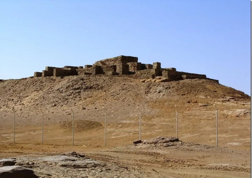
At Qasr al-Hamra, the photograph in this guide shows stone remains. Its caption identifies the site; it does not assign a function or date to every visible course. When reading a ruin, start with the arrangement: boundaries, openings, changes in level and relationships between surviving parts. A ground-level view can make low remains seem like disconnected stones, while an interpreted plan may reveal their organisation.
Compare the photograph with the responsible site's explanation before naming an individual space. A word such as palace in a modern landmark name does not supply a complete floor plan, an occupant list or the sequence of rebuilding. Avoid turning a familiar label into an unsupported reconstruction. The better question is which features and finds support the interpretation of this particular area.
Chronology also needs attention at the scale of a structure. A town may have a long history while a visible wall belongs to one phase, includes repairs or stands above earlier remains. One date cannot automatically describe all of it. For an accessible note, write the named feature first, then the attributed period, then the evidence behind that period if the source provides it. Leave the last field open when it does not.
Connect local development with wider contacts
Tayma's importance is often introduced through its position within wider networks. The DAI project overview discusses connections with neighbouring regions alongside archaeological evidence for the oasis's long development. Those references are valuable, but they should not erase the longer local story. A place can participate in exchange while retaining its own settlement history, production and social relationships.
Think about what different objects might contribute to an account of contact. A documented imported object, an inscription naming someone and a locally produced object influenced by another style do not demonstrate exactly the same relationship. The first may concern movement of goods, the second a textual association and the third a question of production or cultural interpretation. A careful account explains the evidence rather than replacing it with a generic statement that everything travelled by caravan.
For a regional comparison, read AlUla Old Town and Hegra. The purpose is to keep neighbouring heritage narratives distinct, not to assign Tayma the same monuments or historical phases. Compare the question each site helps answer. A settlement, a tomb landscape and an oasis water system can illuminate different dimensions of life in northwestern Arabia without becoming one interchangeable itinerary.

Use the Tayma stele as a specific object
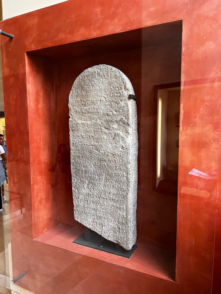
The Louvre's record for Stèle de Teima identifies inventory number AO1505, discovery at Teima, sandstone material and an Aramaic inscription. The museum dates it to the fifth century BCE. Its record, updated 13 May 2026, describes a religious appointment and associated land grants. These details concern one identified object, not every stone inscription from the oasis.
The photograph here was taken at the Louvre in Paris. It therefore connects Tayma's history with a museum object held elsewhere; it is not evidence that the stele is displayed in Tayma. That distinction is useful when planning what you expect to see locally. An online image, a replica and the catalogued original can all contribute to learning, provided their identities and locations remain clear.
Read the catalogue in layers. First establish the object's name and number. Next identify material, language and attributed date. Then consider the interpretation of the text. A readable translation is an expert result; the arrangement of marks in a photograph is not an invitation to invent your own translation. Where a record includes uncertain readings or gaps, those qualifications are part of the evidence. Preserve them rather than making the ancient account seem more complete than it is.
Distinguish a monument visit from a museum encounter
A site visit and an object encounter complement each other because they offer different kinds of context. At a named place, scale and relationships may become clearer: a wall against a lane, a ruin against the wider settlement or palms behind buildings. In a museum, lighting, catalogues and comparison material can help focus attention on an object's details. Neither setting gives a reader automatic knowledge of the other.
The Saudi National Museum reading guide offers a related method for working with objects and labels. Applying that approach to Tayma means asking where an object was found, which collection holds it and how its interpretation was established. It also means resisting the assumption that a display groups objects that were originally used together. The arrangement serves an exhibition's explanation and needs to be read on its own terms.
For a hypothetical learning session, choose one place photograph and one catalogued object. Write a short description of what each allows you to understand. Then write one question that only the other kind of evidence might answer. The place photograph could prompt a question about spatial relationships; the catalogue could prompt a question about the text's setting. This creates a useful conversation between landscape and object without fabricating a connection between specific buildings and finds.

Build a concise evidence notebook
Use a notebook that keeps observations and source-backed claims together without merging them. A compact entry needs the subject, the source or photograph, the date of review and the question still open. For a historical image, include the source's photograph date when available. For an archaeological interpretation, include the publication or project context. Your own review date tells readers when you checked it; it does not make an old event new.
A practical sequence is to begin with the town and region, add one water question, examine one structural question and finish with one object record. This gives the notebook a coherent purpose. It also prevents a long list of names from substituting for understanding. Each entry should help explain the central question: how did water, settlement and wider connections shape the oasis across different periods?
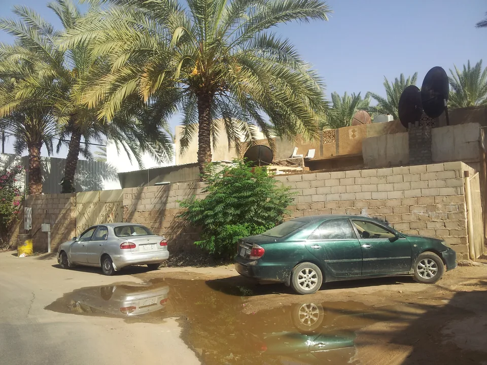
Before sharing the notebook, check its captions against its claims. The wet street photograph below is town context, not evidence about ancient irrigation or today's forecast. The old-town lane is a source view, not a current access map. The ruin needs its own name, and the Louvre stele needs its present collection identified. Four accurate photographs are more helpful than four images asked to prove facts they cannot show.
Choose an informed next step
Start with the four primary and official references linked in this article. Read their dates and scope, then decide whether your next question concerns archaeology, a museum object or a potential visit. Research summaries help explain history; operating details require a current destination or site contact. This guide has not verified present opening hours, tickets, excavation access or a bookable tour, so it supplies no promised itinerary.
If a visit is being considered, identify the exact named places you want to understand before checking current arrangements. Ask which areas are open, what interpretation is available and whether photography is permitted. Use authorised routes and respect barriers; observation does not require touching inscriptions, entering unstable remains or moving material. These are practical habits for protecting the experience and the evidence, not a statement of site-specific access rules.
Tayma becomes easier to understand when the long history is allowed to remain layered. A water landmark raises questions about supply and work; ruins raise questions about settlement and building phases; environmental research extends the timescale; a named stele gives a specific textual connection. Follow the question that interests you most, retain the source beside the explanation and return to the wider oasis whenever a single object starts to stand in for the whole place.
Sources and review
- DAI: Archaeology of the oasis city Tayma — reviewed 4 October 2026. Primary research overview, historical project 2004–2019; not current visitor access.
- DAI: Tayma vegetation and land-use research — reviewed 4 October 2026. Primary environmental methods, historical project 2011–2015; not present water-quality evidence.
- Louvre: Stèle de Teima, AO1505 — reviewed 4 October 2026. Primary object record, updated 13 May 2026; no current gallery availability guaranteed.
- Saudipedia: Archaeological findings in Tayma — reviewed 4 October 2026. Saudi reference dated 26 December 2022; landmark identity, not current operating information.