

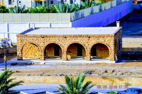
Tabuk Hejaz Railway Station: Read Its Heritage
Understand Tabuk Hejaz Railway station through buildings, rolling stock and dated sources, with a practical method for reading its heritage.

Plan Tabuk city and mountain excursions separately, using precise destinations, verified access and realistic transport arrangements.
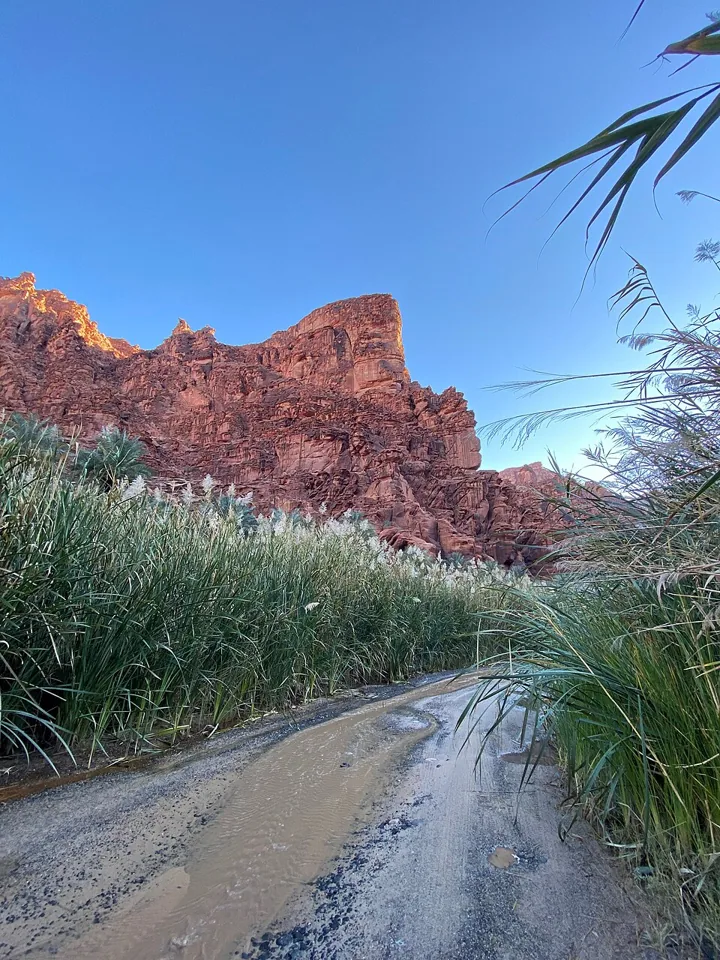
Tabuk city can be a base for exploring northwestern Saudi Arabia, but a mountain destination in Tabuk Region should not be treated as an ordinary city stop. Identify the exact place, travel route and authorised activity before combining them into one day. A regional label can conceal substantial differences in distance, terrain, access and services.
The official Visit Saudi Tabuk destination page provides regional context. Use it to identify possibilities, then verify the actual arrangements for the specific excursion. Start with the Tabuk Region guide, keeping city activities, mountain outings and coastal visits separate in the itinerary rather than assuming one plan suits all three.
Write the destination's actual name and confirm the arrival point. A photograph described only as Tabuk mountains may show a place that is not on your intended route. Different transliterations can also make searching confusing. Use an official destination reference or the operator's confirmed information to establish where the visit begins.
Distinguish a viewpoint reached by an authorised road from a walk, guided off-road outing or heritage stop. Each has different requirements. A vehicle available in the city may not be suitable for a proposed route, and a route visible on a map may have restrictions or changing conditions. Ask the competent local source about the actual activity, not simply whether the destination is beautiful.
The Visit Saudi nature and adventure guide includes Wadi Al Disah as regional travel context. The guide is historical destination information, not a live access notice or an instruction to undertake every route independently. Verify the present arrangements before planning transport or a walking schedule.
For a city visit, choose a small number of accessible places and check their current arrangements. Leave time for meals, rest and movement between them. If you plan to add an excursion, calculate the whole journey rather than only the outward drive. The return, stops and daylight available can determine whether the plan remains comfortable.
An early start can help with a long outing, but it does not make an uncertain route suitable. Ask about the conditions, authorised access and the group's needs first. Avoid copying a social-media itinerary whose vehicle, guide or fitness requirements are unstated. A realistic shorter visit can provide a better experience than a crowded plan that depends on everything going exactly as hoped.
For a different Saudi mountain setting, the Al Hada and Taif guide offers useful planning questions. Tabuk and Taif are distinct destinations; the comparison concerns method, not identical conditions. Keep the actual route information central rather than applying a travel time or road description from another region.
Check current forecasts and relevant official notices for the destination, not only the city base. A regional trip may encounter conditions different from those at the hotel. Ask a competent operator what those conditions mean for the planned activity. Do not interpret a clear city forecast as confirmation that an exposed route is appropriate.
For an organised outing, confirm what transport, guiding, equipment and assistance are included. Describe any mobility or health needs that affect participation. A broad adventurous label does not answer whether the person can safely and comfortably complete the route. Obtain a clear explanation before booking, and preserve a less demanding alternative where useful.
Use authorised paths and respect closures or restricted areas. Do not approach an edge, disturb a heritage surface or drive across uncertain ground for a photograph. A familiar-looking landscape can still require local knowledge. This article does not certify a route, recommend an unsupported off-road journey or replace the operator's current instructions.
Notice rock forms, vegetation and the relationship between valleys and higher ground. Ask a guide which geological or historical explanations are supported for the place. A striking rock or visible marking can prompt curiosity, but a photograph alone does not establish its age or purpose. Keep your description of what you saw separate from an interpretation supplied by a credible source.
If heritage features are included, follow site rules and do not touch, trace or alter them. The Hail rock-art guide explains why careful observation and documented interpretation matter. Hail's sites and a Tabuk excursion remain separate places; do not transfer a date or cultural attribution from one to another.
Caption images with the verified feature and location. A space photograph of a region is not the same as a ground-level view of the route, and a photograph of one mountain cannot illustrate every excursion. Accurate images help readers understand the kind of setting while preserving the limits of what the picture actually shows.
If continuing to AlUla, read the AlUla Old Town and Hegra guide and treat those visits as separately arranged destinations. Their geographic and visitor context differs from Tabuk. A wider road journey needs deliberate planning rather than a chain of attractive map pins with assumed opening and transport arrangements.
Finish with a clear itinerary naming the city base, exact excursion, transport and verified access information. Record what remains uncertain and arrange an alternative before it becomes urgent. That gives you a richer Tabuk experience: time to notice the landscape and the city, supported by a plan that respects their different scales and practical requirements.
Explore About Tabuk Region, Saudi Arabia
Understand Tabuk Hejaz Railway station through buildings, rolling stock and dated sources, with a practical method for reading its heritage.
0 properties selected