
Wadi Hanifa: Understanding Riyadh Through Its Landscape
Explore Wadi Hanifa as part of Riyadh life, with a practical method for choosing an accessible destination and reading the valley landscape.

Read Riyadh through the valley
Wadi Hanifa offers a way to understand Riyadh beyond towers, roads and business districts. The valley's landscape brings water management, open space and the city's relationship with its terrain into the same view. For a visitor or someone considering everyday life in Riyadh, the useful question is how a particular accessible stretch fits a real outing, not whether the entire valley can be treated as one park with uniform facilities.
The RCRC voluntary local review for Riyadh, reporting on 2024, discusses Wadi Hanifah's rehabilitation and open-space projects. It provides official planning context rather than a live guarantee of access to every area today. This article offers an original way to observe the landscape and plan a respectful visit; it does not announce a new opening.
Distinguish the valley from an individual destination
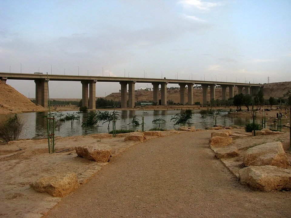
A name on a map can refer to a broad landscape, a park, an access point or a nearby neighbourhood. Choose the exact destination before arranging transport. Check its current entrance, permitted activities and any access information supplied by the responsible operator. A photograph showing water and trees establishes the scene photographed, not the facilities available at every location using the Wadi Hanifa name.
Use the Riyadh Region guide to place the valley in the wider landscape. Then narrow the plan to one manageable stretch. This is especially useful for a first visit: an identifiable arrival point and a realistic return route allow you to spend time observing instead of driving between vaguely selected map pins.
Keep Wadi Hanifa and other named valleys or parks distinct. A nearby destination may be connected to the broader landscape without sharing the same entrances, rules or facilities. Ask which site a recommendation actually refers to. That small clarification can prevent a family outing from being built around services that belong somewhere else.

Notice how water, terrain and public space relate
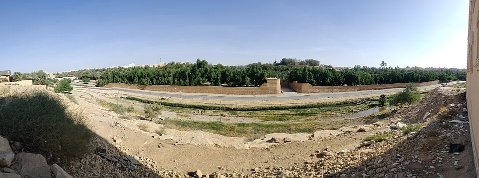
During an accessible visit, look at the relationship between the watercourse, planted areas, paths and surrounding development. Which spaces invite people to pause? Which parts are managed for movement or environmental function? These observations make the valley interesting even without memorising a list of project statistics. They show that an urban landscape can serve several purposes at once.
Avoid assuming that visible water is suitable for swimming or drinking. Follow posted rules and current instructions. Do not enter a channel or a closed area to obtain a photograph. A landscape that appears calm during your visit can still require specific safety and environmental management. Observing it from an authorised route is both more respectful and more informative than treating it as an unregulated outdoor playground.
The climate and seasons guide helps frame the conditions of an outing. Check current weather and alerts, especially when conditions could affect outdoor access. A seasonal preference is not a forecast for the day you travel, and one pleasant evening does not describe comfort throughout the year.
Plan for the people making the trip
Consider how much walking the group wants, whether shade or seating is necessary and how children or older visitors will manage the route. Verify current facilities rather than relying on an old review. If a continuous step-free route matters, obtain specific information about the entrance and path instead of assuming accessibility from a wide walkway in a photograph.
Bring appropriate drinking water and plan breaks for the conditions. Keep the return journey realistic; an attractive route can feel different when the group is tired or the temperature changes. If using a taxi or other arranged transport, identify a practical pickup location in advance. Do not assume that a broad valley name is enough to help a driver find you.
A simple first outing might focus on a short authorised walk, time to observe the landscape and a planned meal elsewhere. This is a planning example, not a recommended fixed itinerary or statement that food services exist at your chosen access point. Adjust it after checking the actual site and the needs of the group.
Use outdoor access as one part of city life
For someone researching a move, visit from the neighbourhood where you expect to live. The everyday journey matters more than a city's general claim to green space. The Riyadh city guide gives broader context, while your own trip helps test whether a particular outdoor destination would become a regular habit or an occasional excursion.
Do not turn a pleasant park visit into a claim about nearby property value or ownership eligibility. Those require separate evidence and review. The valley can enrich your understanding of Riyadh without serving as a promised investment premium. Keep the cultural and lifestyle observation distinct from a purchase decision.
Leave with a clearer sense of the place
Record the destination, date, weather and what was actually accessible. Notice how the landscape differs from the parts of Riyadh you already know. A second visit under different conditions may reveal another pattern of use, but respect closures and avoid implying that every observed activity is permitted elsewhere.
Wadi Hanifa is most rewarding when approached as a managed landscape with a role in the city's life. Choose a specific authorised destination, give yourself time to observe and keep your expectations grounded in current access information. That approach turns a simple outing into a more useful understanding of how Riyadh's terrain and everyday life connect.
Sources and review
- RCRC Riyadh voluntary local review 2024 — reviewed 29 September 2026. Primary source for factual context; examples and decision methods are original editorial analysis.