
Fayfa Mountains: Read the Terraces and Settlements
Understand Fayfa in Jazan through terraces, mountain settlement and weather, with a respectful visitor framework and source-backed context.
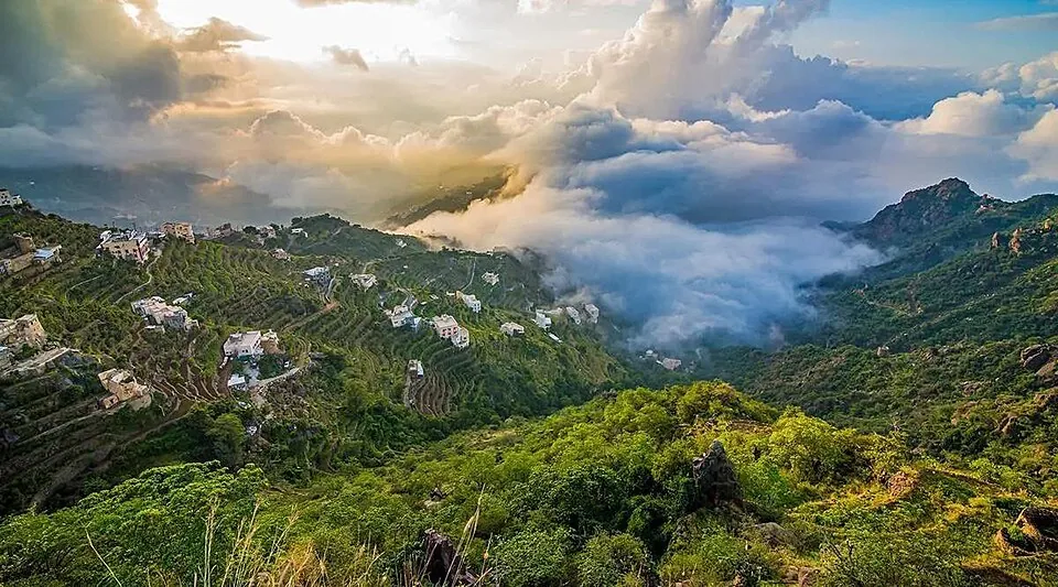

Fayfa in Saudi Arabia's Jazan Region is best understood as a lived-in mountain landscape shaped by steep slopes, agricultural terraces, stone buildings and changing weather. It is not simply a green viewpoint above the coastal plain. For a visitor, the rewarding question is how people have worked with this terrain over time: where water moves, why fields are stepped into the hillsides, and how a route that looks short on a map can become slow on mountain roads. This guide focuses on place and respectful travel, not on land availability or property investment claims.
The Saudi Press Agency's Fayfa Mountains account describes terraces, cloud formations and stone houses, and names Al-Absiya, Al-Samaa and Al-Khatm as viewing areas. A separate account of Jazan's mountain terraces explains that these structures help farmers manage soil, water and cultivation on steep ground. Both are useful descriptions of the region; neither guarantees current opening hours, road conditions or a particular view on a particular day. Details were reviewed for this article on 1 October 2026.
See the terraces as working infrastructure
From a distance, a terraced hillside can resemble a pattern drawn for photography. Up close it is a practical response to slope. Stone edges create narrow usable surfaces, slow runoff and help retain soil. Their form reflects ongoing labor, maintenance and local knowledge rather than a single historic building phase. When the growing season or recent rain changes the vegetation, the same hillside can look very different. That variation is part of the landscape, not a failure to match a promotional image.
The Saudi Press Agency identifies coffee, corn, millet, sesame and aromatic plants among crops associated with Jazan mountain terraces. That is a regional description, not a statement that each Fayfa field grows all of them. Observe from public routes and avoid walking onto a cultivated terrace without permission. Stone edges may be fragile, and a planted plot is someone else's working land. A thoughtful visitor leaves gates, walls and irrigation routes as found.
Read the mountain settlement
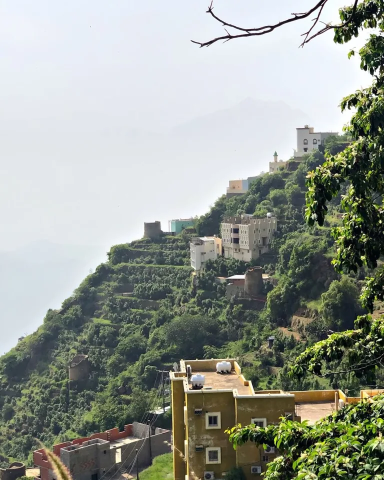
Fayfa's buildings, paths and fields sit within a compact, steep setting. A view of a stone house makes more sense when considered with its access path, neighboring fields and exposure to rain and sun. Notice how movement between levels differs from a flat city block. The distance between two visible points says little about the time or effort needed to reach them safely.
This is also a reason not to treat a photograph as a generic “Saudi village” image. The mountains of Jazan have their own terrain and cultural setting. Compare them with the earthen architecture in our Najran guide or the coastal and island environments in the Farasan Islands article. The differences explain more about Saudi Arabia than a single national landscape stereotype could.

Plan for weather and access
Mountain conditions can shift during a visit. Mist may obscure a viewpoint, while rainfall can change visibility, footing and travel times. The Saudi Press Agency's August 2026 report on Jazan mountain rains describes seasonal greening and fog; it should be read as a dated observation, not a forecast for your travel day. Consult current official weather and road notices before departure, especially if the route involves narrow or steep sections.
Give the day slack. A plan that requires several viewpoints, a long drive and a fixed return time leaves little room for traffic or a weather change. Choose a small number of stops, check whether they are publicly accessible, and confirm facilities locally. Carry water and suitable footwear even if the main activity is photography. If visibility falls, do not press on merely to recreate an image. A safe pause can be more worthwhile than a rushed viewpoint.
Visiting at a quieter hour can make it easier to appreciate the terraces and settlement pattern without obstructing residents. Park only where permitted and keep access clear for local traffic. Ask before photographing people or private homes. Where an organised local guide is available, a knowledgeable explanation can help connect a view with agricultural and community life, but verify the guide's current offer and terms rather than assuming one is always available.
Put Fayfa within Jazan's wider geography
Jazan Region also includes coastal plains, towns and the Red Sea. A mountain excursion and a coastal day are different experiences with different travel and weather considerations. The Jazan Region section provides a broader entry point; the Fayfa question is about one highland setting within that larger region. The sea-facing Farasan Islands do not provide a substitute for understanding the mountain terraces, just as a mountain photograph does not describe the coast.
There are useful connections to other Saudi mountain places without making them interchangeable. Our Rijal Almaa architecture guide discusses a different built landscape in Aseer. An Al Baha forest outing presents another set of terrain and weather choices. Reading across these places helps a visitor ask better questions about materials, agriculture and movement rather than assuming that all green highlands share one story.
A respectful one-day framework
Before setting out, decide whether the main goal is a landscape view, learning about terraces, or a relaxed stop in a mountain community. Check the latest weather and route information, then choose a public viewpoint or two that serve that purpose. On arrival, orient yourself: where is the slope, where are the terraces, where do paths and buildings connect? Take time to observe before moving on.
If conditions permit, continue to a second stop with a different angle rather than repeating the same photograph. Keep private land and cultivated plots undisturbed. The experience remains worthwhile even when mist limits a panorama because it reveals how weather is part of the place. Finish with enough daylight and time for the return route. Fayfa rewards attention to the relationship among land, work and settlement more than a checklist of viewpoints.
Sources and review
- Saudi Press Agency: Fayfa Mountains, 30 July 2024 — reviewed 1 October 2026. Dated description of Fayfa terraces, viewpoints and stone houses.
- Saudi Press Agency: Jazan mountain terraces, 3 July 2026 — reviewed 1 October 2026. Explains agricultural terrace construction and use across Jazan.
- Saudi Press Agency: Jazan mountain rainfall, 19 August 2026 — reviewed 1 October 2026. Dated weather and landscape context; not a travel forecast.