
Farasan Mangroves: Roots, Channels and Coastal Habitat
Read Farasan’s mangrove roots, channels and coastal connections with dated official sources and careful photograph interpretation.
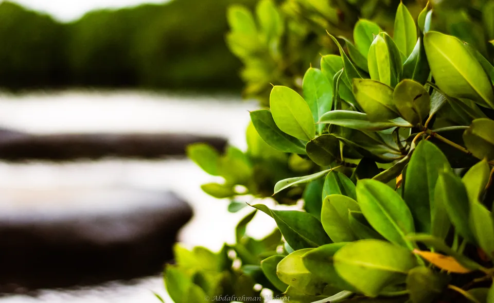

Farasan’s mangroves are a living shoreline
Farasan’s mangroves are coastal habitat where trees, shallow water and sediment form a connected environment. Understanding that relationship is more useful than treating the forest as a green backdrop. Read the water channels, root structures and vegetation edges together, and keep what you can actually observe separate from what requires a survey. This guide explains how to make that distinction without collecting plants, entering sensitive ground or turning a photograph into a scientific measurement.
The islands sit within Saudi Arabia’s Jazan Region in the southern Red Sea. UNESCO’s Juzur Farasan profile describes an archipelago of more than 170 islands and islets, with mangrove stands among reefs, seagrass, salt marsh and other coastal communities. Its conservation purpose also includes the well-being of island communities. Reviewed on 4 October 2026, that profile supplies the geographic context; the observation exercises below are our own interpretation, rather than an official field protocol.
Start with the Jazan Region guide to place Farasan within the wider region. Then narrow your question to the mangrove habitat itself: what connects the trees to the shore, what information does a particular view provide, and what would you need to investigate further?

A forest that belongs to the water’s edge
NOAA explains mangroves as trees and shrubs occupying the coastal intertidal zone. Their roots grow in conditions very different from an inland garden, including oxygen-poor soils and moving coastal water. The same explanation describes sediment settling around roots and the shelter that root structures can provide. These are general ecological functions, not measurements of a particular Farasan channel.
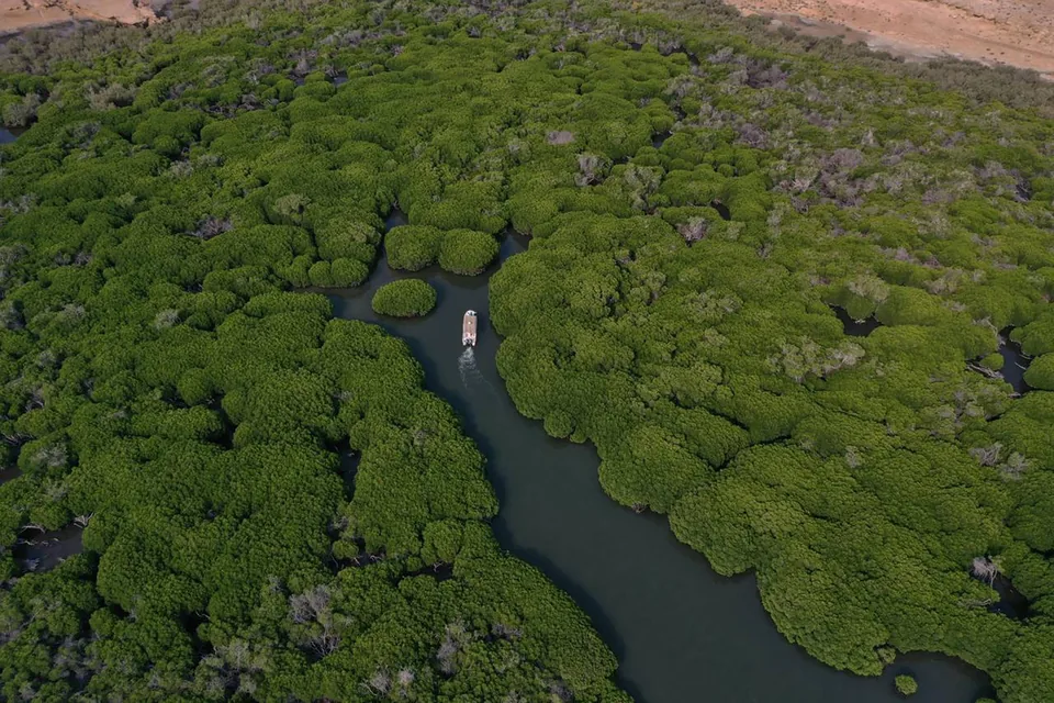
An island photograph can therefore be read in layers. Begin with the visible vegetation boundary, then find the water surface, then look for exposed ground. If the angle hides one layer, leave it unknown. An aerial image may reveal an outline while concealing the roots beneath the canopy. A close shoreline image may reveal roots while showing very little of the forest’s extent.
Avoid importing a familiar inland meaning of forest. A gap between mangrove stands may contain a water passage rather than a walking trail. Ground that looks bare may be covered at another water level. Neither a dense canopy nor an open patch tells you, on its own, where a visitor can safely or legitimately go.

Read the channel before counting the trees
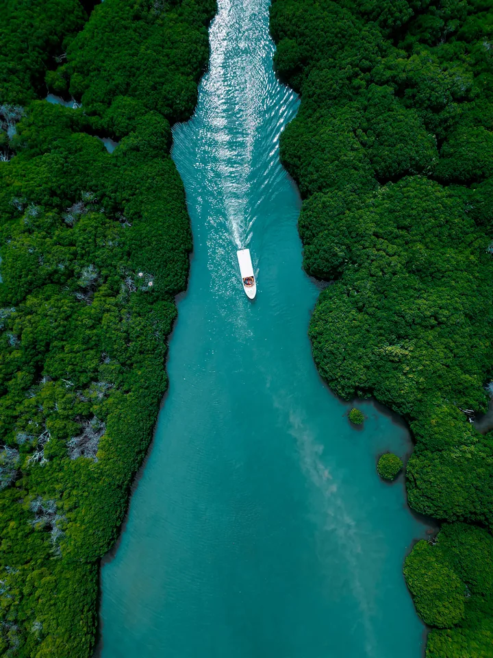
A useful first exercise is to trace the visible water channel without estimating its dimensions. Does it run between vegetation on both sides, widen towards the edge of the image, or disappear behind a bend? Describe only the section you can see. A photograph does not establish the channel’s full length, flow direction, depth or connection to the open sea.
The two Qandal photographs in this article show different perspectives on vegetation and water. Compare them as different views, not as a before-and-after study. Their source labels and embedded dates do not form a controlled monitoring sequence. Differences in camera height, framing and water conditions can change the apparent amount of open water without demonstrating that a habitat has expanded or declined.
Roots are structures to observe, not stepping stones
Roots help explain why a mangrove shoreline is distinctive. The Smithsonian’s mangrove overview describes several adaptations, including upright breathing roots in Avicennia and arching support roots in Rhizophora. It explains how specialised structures help plants cope with oxygen-poor soil. Mangroves also use differing ways of dealing with salt. These general botanical explanations do not identify every tree in our photographs.
Where an authorised viewpoint allows a clear look, describe the shape before naming it. Are projections upright, arching, branching or partly submerged? Is the connection to the trunk visible? A distant dark mark might be a root, shadow or object; certainty should follow the quality of the view. You can learn from the structure without assigning a species from an indistinct image.
Keep observation separate from contact. Do not use roots for balance, clear a passage through them or pull material out to improve a photograph. If the feature cannot be seen from the permitted route, use interpretation or a published close-up. A good explanation does not require the reader to reach the most fragile part of the habitat.
Match every photograph to its actual place
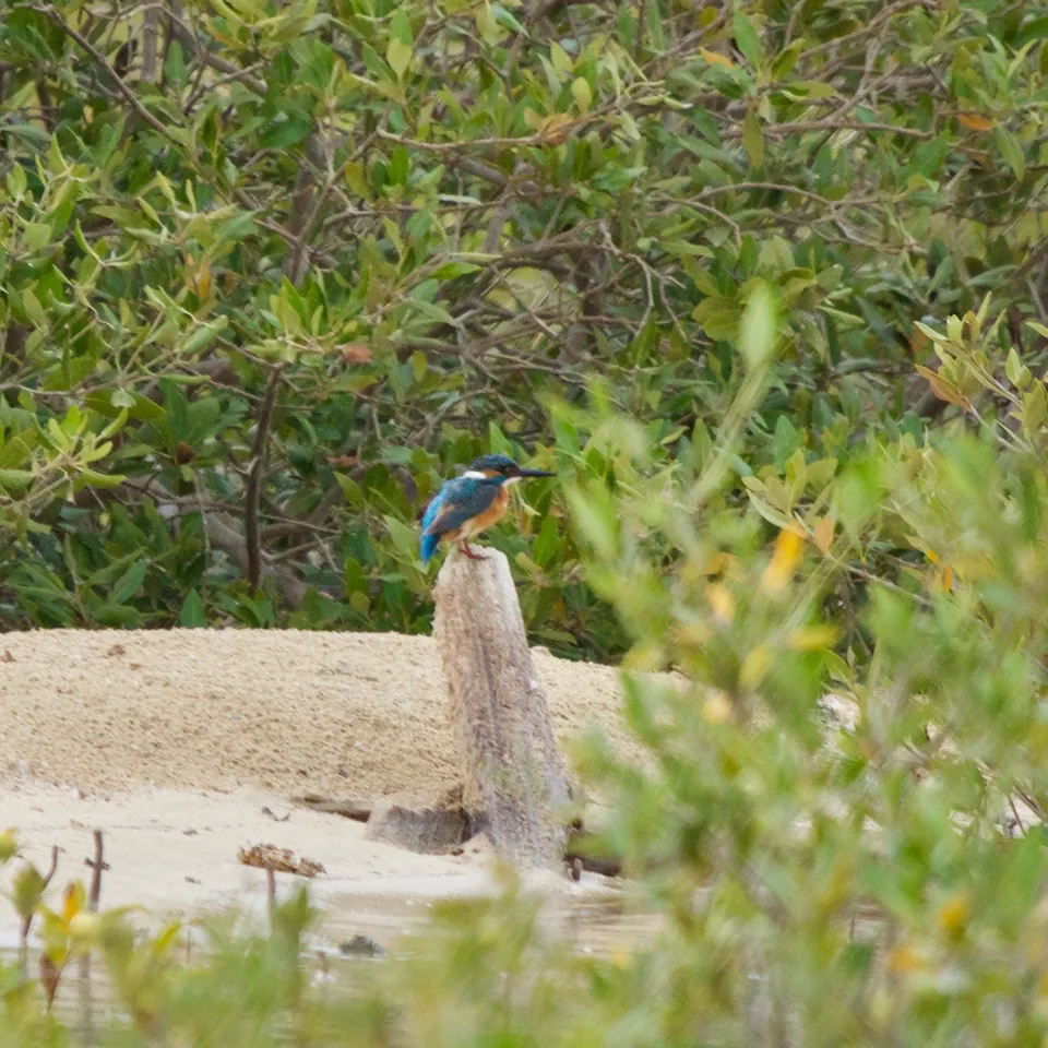
The first three photographs here depict Farasan mangrove settings. The fourth shows a common kingfisher at Thuwal, elsewhere on Saudi Arabia’s Red Sea coast. Its purpose is comparative coastal-wildlife context. It is not evidence that the photographed individual, or an identical encounter, belongs to Farasan. Keeping that distinction visible makes the image useful without changing its geographic meaning.
For the Qandal images, those date differences are disclosed in the captions. We use the pictures to illustrate physical habitat, not to date a conservation outcome. If you keep your own notes, preserve the original label and explain any uncertainty rather than silently choosing the most recent date. That small discipline prevents a historical image from acquiring an unsupported current claim.
Habitat connections matter beyond the canopy
UNESCO identifies Farasan as a mosaic of marine and terrestrial environments. Its description connects mangroves and seagrass with coastal stabilisation, sediment trapping and nursery habitat supporting biodiversity and livelihoods. That is a reason to look beyond a single line of trees. It does not mean that every ecological function is equally strong at every photographed spot.
Try drawing a simple sequence in your notes: landward vegetation, mangrove edge, visible water and the wider coastal setting. Mark any missing link as unknown. This is an observation aid, not a habitat map. It encourages you to ask how the visible stand relates to neighbouring environments without pretending that the camera has shown the complete ecosystem.
The Farasan Islands nature guide deals with the broader island experience and access planning. Use this article for the narrower habitat question. A place can offer several kinds of understanding, and seeing one coastal forest does not complete your knowledge of its reefs, settlements, fisheries or other environments.

A bird sighting is one observation
Wildlife adds another layer to a coastal visit, but it should be recorded at the scale of the encounter. If a bird is visible from the authorised route, note the time, place, behaviour and quality of your view. Keep an uncertain identification uncertain. A photograph with a clear subject may still lack the features needed for a confident species identification.
The Thuwal kingfisher photograph illustrates the value of a precise individual record. It shows a bird in one place, not a population trend or the full biodiversity of Saudi mangroves. Likewise, seeing no bird during a short Farasan stop does not establish that the habitat has little wildlife. Your observation period, viewpoint and conditions limit what you can conclude.
Use distance and patience rather than feeding, playback or pursuit. A bird that leaves the frame has not spoiled the outing. Describe the habitat around the encounter as well as the animal: a branch, water margin or sheltered edge may help you explain why that view was interesting. Do not add nesting, breeding or migration claims unless a relevant source supports them.
Water level changes the view you can read
An intertidal setting asks for a different approach to repeat photography. A waterline records a moment. It cannot serve as a permanent boundary between land and sea, and it does not supply the day’s safe operating conditions. The general explanation of tides in mangrove ecology should not be converted into an exact Farasan timetable or a universal twice-daily schedule for every channel.
Suppose you compare two views from a permitted viewpoint. Before describing a change, ask whether the camera position, direction, time and water conditions are comparable. If they are not recorded, label the comparison visual rather than quantitative. More exposed sediment in one image might reflect a different water level; a wider-looking channel might reflect the camera angle.
For an actual outing, get current route and activity instructions from the responsible operator. Our Saudi climate and seasons guide provides wider context, while the specific day needs current information. Neither an old photograph nor a general ecology explanation substitutes for local weather, marine conditions or an authorised access arrangement.
Restoration means more than a planting total
The National Center for Vegetation Cover Development and Combating Desertification’s 23 July 2024 account of mangrove projects describes nursery preparation, healthy seed collection, planting and protective care. It is a dated account of activities. We do not use it as an October 2026 survival census, a measurement of Qandal’s area or proof that every planted seedling became an established tree.
When reading a restoration claim, separate the activity from the outcome. A planting count answers how many seedlings were reported as planted. Survival requires later observation; habitat recovery requires a broader question about condition and function. The reporting period, location and method should remain attached to each statement. Combining different projects into one undated success claim loses that information.
A useful question for an interpretation session is how progress is monitored after planting. Ask what is observed, how often and over which area. The answer may be qualitative or limited, and that is still more informative than assuming the planting photograph completes the evidence. Keep the distinction even when the project’s purpose is worthwhile.
Blue carbon needs evidence beneath the surface
The Smithsonian describes coastal carbon storage in plant material and sediment, often called blue carbon. This gives mangroves a significance that a scenic view alone cannot convey. It also creates a temptation to attach a carbon number to any visible forest. We provide no carbon-stock estimate, offset claim or financial value for Farasan in this article.
To assess a numerical claim, ask what was measured and over which area. A canopy photograph does not tell you sediment depth, carbon concentration or how sampling represents the entire site. An annual storage rate and an accumulated carbon stock also describe different quantities. Their units and time periods must be clear before they can be compared.
Keep conservation reporting tied to its date
The National Center for Wildlife’s 20 July 2023 marine-habitat assessment announcement describes work on Red Sea reefs, seagrass, mangroves and associated species, including risks linked to natural processes and human activity. Its publication date matters. This is background for understanding what assessment involves, not a new announcement issued during our October review.
Use that distinction when discussing condition. A programme designed to investigate a habitat does not, by itself, tell you the latest results at a named channel. Look for a subsequent report, its survey area and its methods before turning the announcement into a conclusion. If no suitable results are available, say that the condition is not established by the material you have read.
Build a short habitat-reading record
After viewing a permitted mangrove setting, organise your notes under four questions: where was the viewpoint, what physical relationship was visible, which explanation had a source, and what remained uncertain? A few clear sentences can answer them. Keep the original photograph separate from any sketch or interpretation so someone reviewing your notes can see the same evidence.
For example, describe a curving channel bordered by dense vegetation, then record that its depth and full route were not visible. Add the general root-and-sediment explanation with its source. Do not attach a species count, forest age or current restoration status that the view cannot support. This turns an attractive image into a useful learning record while preserving its limits.
Connect the habitat to the Jazan city guide when considering the mainland and island geography. Jazan city and a Farasan mangrove channel are distinct settings. Accurate place names help you keep photographs, journeys and ecological explanations aligned, especially when sharing an account with someone unfamiliar with the region.
Questions worth taking into the next reading
Is every green shoreline a mangrove forest? Do not identify it solely by colour. Use location, visible features and a reliable explanation, and leave uncertain vegetation unnamed. Does an aerial photograph show the forest’s ecological health? It supplies a view of visible form, while health assessment needs a defined method and additional evidence. Does a conservation designation guarantee visitor access? Confirm the exact route and permitted activity through current responsible arrangements.
The most useful next step is to compare the three Farasan views again with those questions in mind. Trace the water, locate the vegetation edge and identify what each camera angle conceals. Then read the linked island guide for practical journey context. You will have a more precise understanding of the mangrove setting, without asking a photograph or a short outing to answer questions it cannot resolve.
Sources and review
- UNESCO: Juzur Farasan Biosphere Reserve — reviewed 4 October 2026. Archipelago geography, habitat mosaic and community context.
- NOAA: What is a mangrove forest? — reviewed 4 October 2026. General intertidal habitat and roots; updated 23 September 2026.
- NCW: Marine habitat assessment — reviewed 4 October 2026. 20 July 2023 assessment announcement; background, not current survey results.
- NCVC: Coastal mangrove planting — reviewed 4 October 2026. 23 July 2024 planting and care account; not a current survival census.
- Smithsonian Ocean: Mangroves — reviewed 4 October 2026. General root adaptations and coastal carbon; no Farasan measurements.