
Hail Rock Art: Read the Landscape Before the Symbols
Understand Hail rock art through Jubbah and Shuwaymis, the landscape, verified interpretation and careful conservation-minded visiting.

Start with the setting of the evidence
Hail's rock art is most informative when the carved surfaces are understood within their landscape. The visitor's question is not only what a figure might represent, but how people used and moved through the environment around it. Use the site's verified interpretation and an authorised route rather than assigning your own dates or meanings to every visible mark. A striking image deserves a careful explanation.
UNESCO's Rock Art in the Hail Region entry identifies two components: Jabal Umm Sinman at Jubbah, and Jabal al-Manjor and Raat at Shuwaymis. It connects the evidence with landscapes that formerly contained water and describes a long history of human and animal representations. This establishes the article's heritage context; the visit method below is original reader guidance.
Keep Jubbah and Shuwaymis distinct
The World Heritage name describes more than one component, not one compact city attraction. Confirm which location your proposed visit covers and where you meet the guide or operator. A general Hail booking should not be assumed to include both sites. Ask about the actual route, duration and access arrangements before coordinating other activities around it.
The Hail Region guide helps place the sites within the wider landscape, while the Hail city guide provides a different scale of orientation. Do not treat the city and the archaeological components as interchangeable destinations or infer travel time from the shared regional name.
Check current official or operator information close to the visit. Access, guide arrangements and facilities may change. UNESCO's heritage description is not a live booking page. An old travel account can explain an earlier experience, but it does not guarantee the same route is available today.

Look at the rock and terrain before the details
From the authorised viewing area, notice the position of the surface, the surrounding terrain and how the site is approached. These relationships help you understand why setting matters to archaeological interpretation. A close photograph can isolate a figure beautifully while hiding the scale and location that make it meaningful.
Ask the guide which environmental relationships are supported by the site's evidence. Distinguish a verified explanation from a general visual impression. You can observe that a surface faces a particular part of the landscape, but you should not infer its original purpose or the exact route of ancient travel from that observation alone.
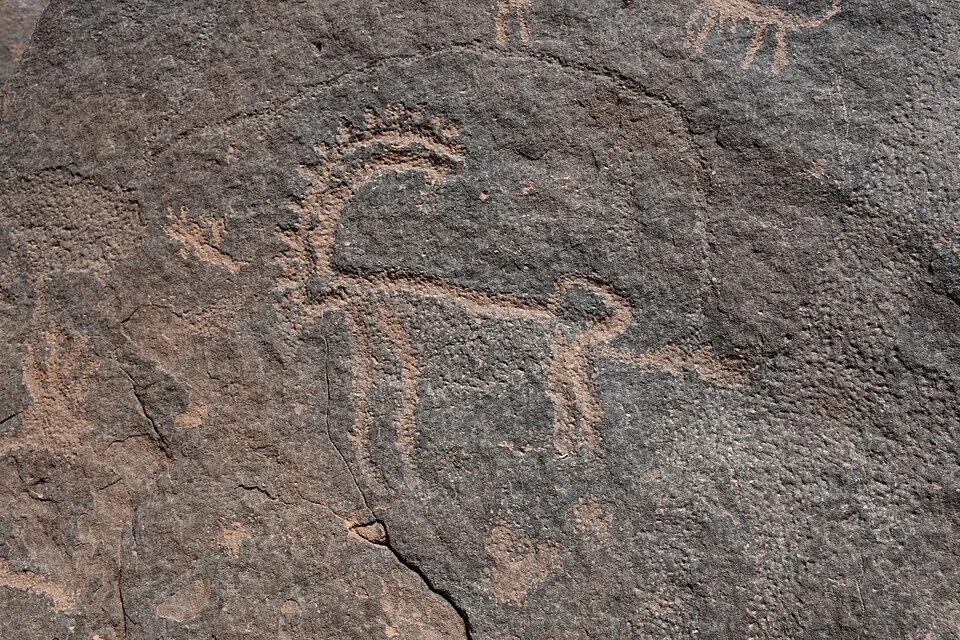
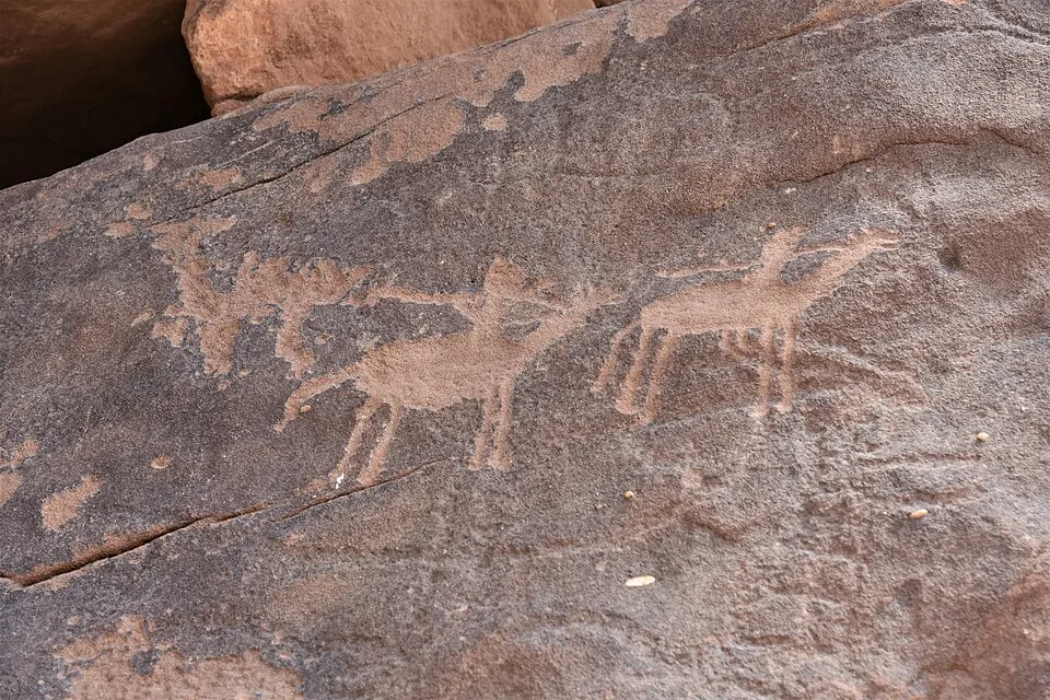
Both photographs accompanying this article show carved rock surfaces at Jubbah in Hail Region. The first focuses on a horned animal figure; the second shows a different panel with animal and human figures. Their captions identify what is visible without assigning archaeological dates or meanings from appearance. Use the site’s verified interpretation to understand the evidence.
Read figures with appropriate uncertainty
Ask how specialists distinguish different types of marks, inscriptions and representations at the site. Do not assume every visible line was made at the same time or by the same community. If an interpretation is uncertain, keep that uncertainty in your notes. The fact that a figure resembles a familiar animal does not establish its precise age or meaning without supporting analysis.
Use the guide's or site's explanation to understand which features are particularly significant. A visitor does not need to memorise every detail to appreciate the evidence. A few well-explained examples can be more useful than a rapid catalogue of guessed meanings. Keep your photographs connected to the explanation and the correct location where photography is permitted.
Avoid making an inscription translation from an online image or another visitor's confident statement. Ask for the verified source if the wording matters. An accurate account can state that an inscription was observed and explain the limits of the available interpretation without inventing a translation to make the story feel complete.
Protect the surface and its surroundings
Follow the authorised route and conservation instructions. Do not touch, trace, chalk, wet or clean the surface to improve visibility. Do not climb or lean against archaeological features for a photograph. The condition and context of the material are part of the evidence, so a seemingly small intervention can undermine what makes the site valuable.
Respect barriers even when a feature appears close. Ask staff where observation and photography are permitted. If you notice damage or inappropriate behaviour, use the site's responsible reporting route rather than attempting to repair anything yourself. A careful visitor helps preserve the experience for others without taking on a conservation role they are not qualified to perform.
Plan the journey and time outside
The travel and transport guide provides a broader framework for the trip. Confirm the vehicle, pickup point, return and facilities for the actual archaeological destination. Prepare for the time outdoors and the needs of the group rather than assuming every site provides the same shade or services.
Use the climate and seasons guide for seasonal context and current official weather for the day. Leave room for changes advised by the operator. A heritage visit should not depend on ignoring conditions to keep a tightly packed itinerary.
Hail's rock art offers a way to connect human expression with a changing environment. Keep the components distinct, observe the setting, rely on verified interpretation and leave the material untouched. The result is a deeper understanding of the place, with room for uncertainty where the evidence does not support a simple answer.
Sources and review
- UNESCO Rock Art in the Hail Region — reviewed 29 September 2026. Primary source for factual context; examples and decision methods are original editorial analysis.